Click on the image at right to get linked to a page offering the full size map in several formats.
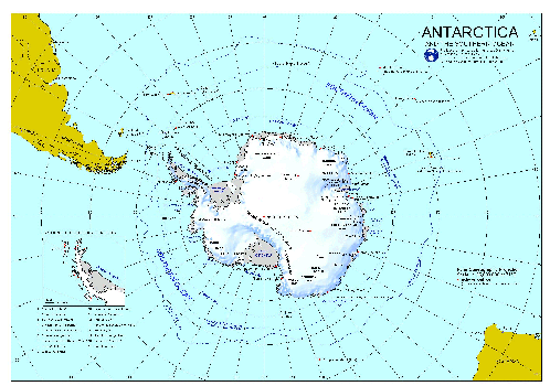
| At right is a thumbnail of a great quick reference map of the continent, produced by the Australian Antarctic Data Center. Click on the image at right to get linked to a page offering the full size map in several formats. |
|
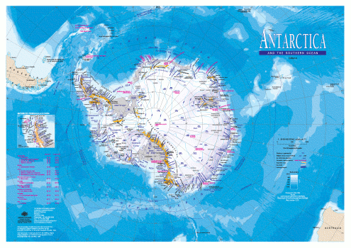
| This map is a more detailed map of the continent, also produced by the Australian Antarctic Data Center. Click on the image at right to get linked to a page offering the full size map. The only available format is PDF. |
 |
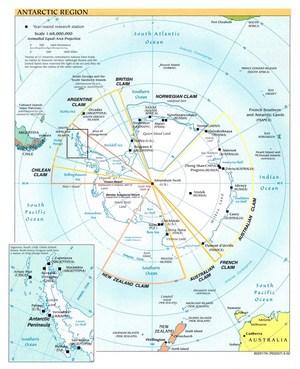
| At right is a CIA-produced political map of the continent showing the major research stations established on the continent. The territorial claims shown (all were effectively nullified by the Antarctic Treaty) are a bit confusing, but they're a bit clearer in the image below. Click on the image at right for the full size map. |
 |
| The individual territorial claims. All of these claims were effectively nullified by the Antarctic Treaty, which states that no territorial claim will be acknowledged, although the Treaty also states that it has no effect on the claims. Before signing the treaty, the US and USSR specifically reserved the right to make claims in the future. | 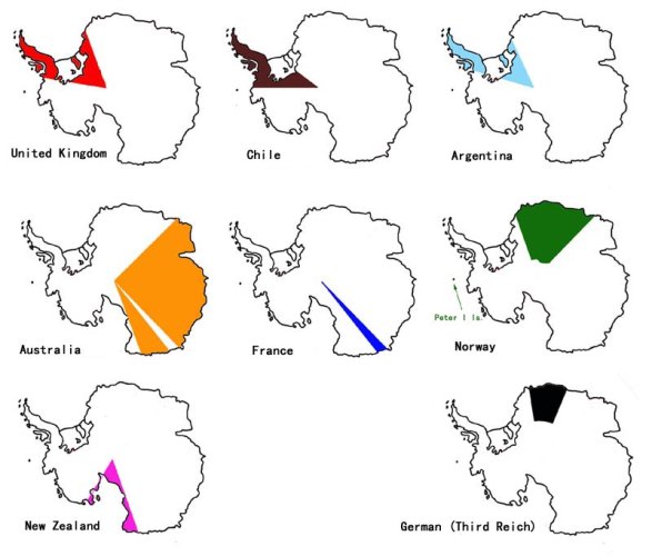 |
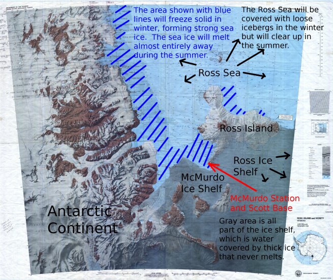
| An topographic map of Ross Island produced by the USGS and marked up by myself. An unmarked and higher-resolution version, actually a scan of a printed map, can be found at the USGS USARC here, under "Ross Island & Vicinity". |
 |
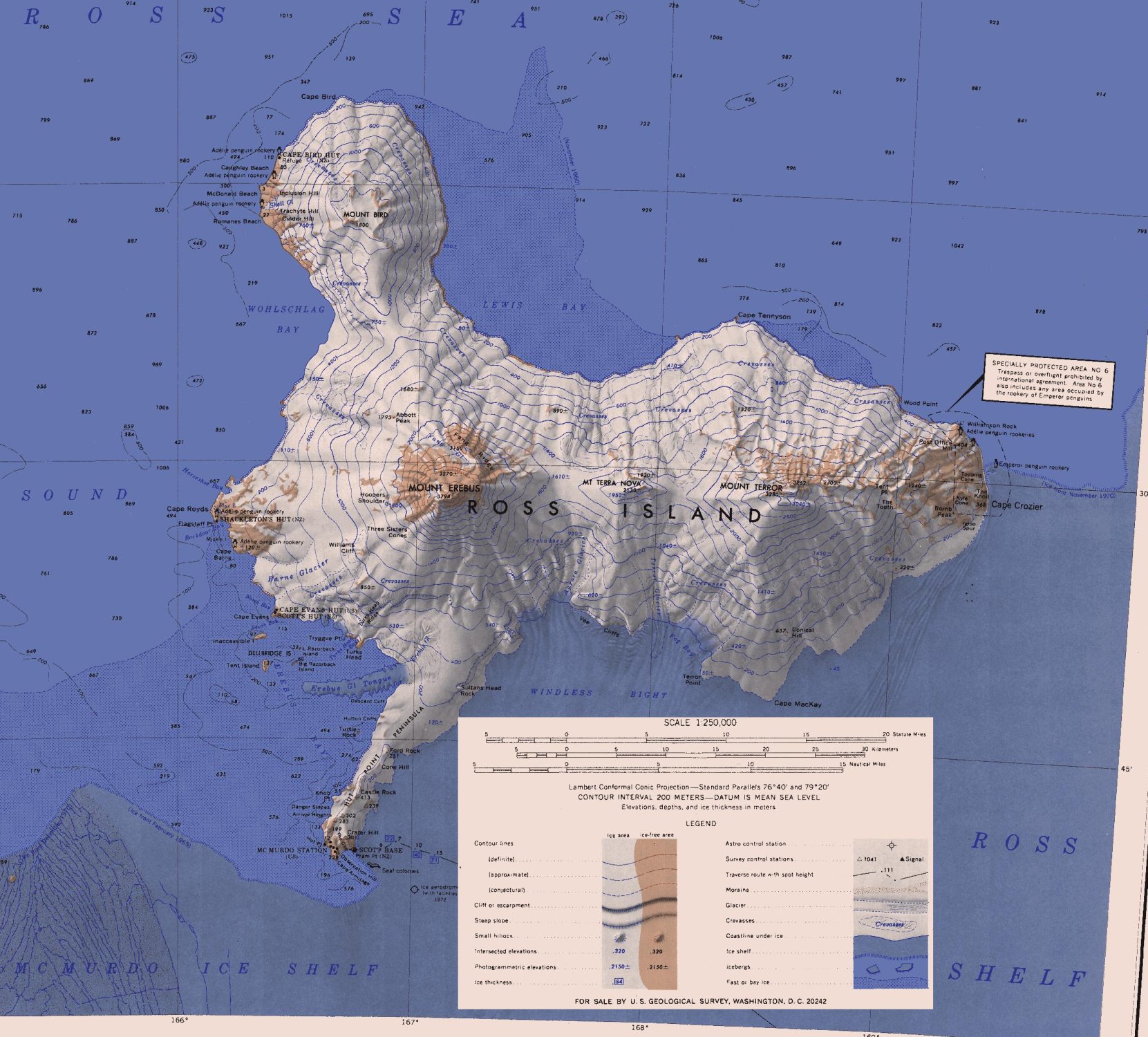
| This is a cropped version of the most recent (1970) topographic map of Ross Island that I've encountered. Produced by the USGS. Click on the image at right for a larger version of this map. The original, uncropped, and biggest version of this map can be found at the USGS US Antarctic Resource Center, here under "Ross Island". |
 |
| A zoom of the preceeding map, showing Hut Point Peninsula. | 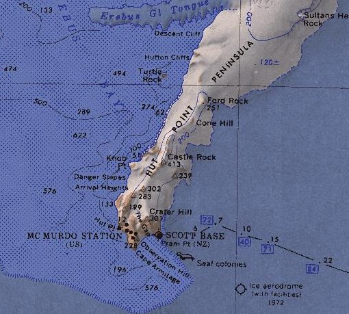 |
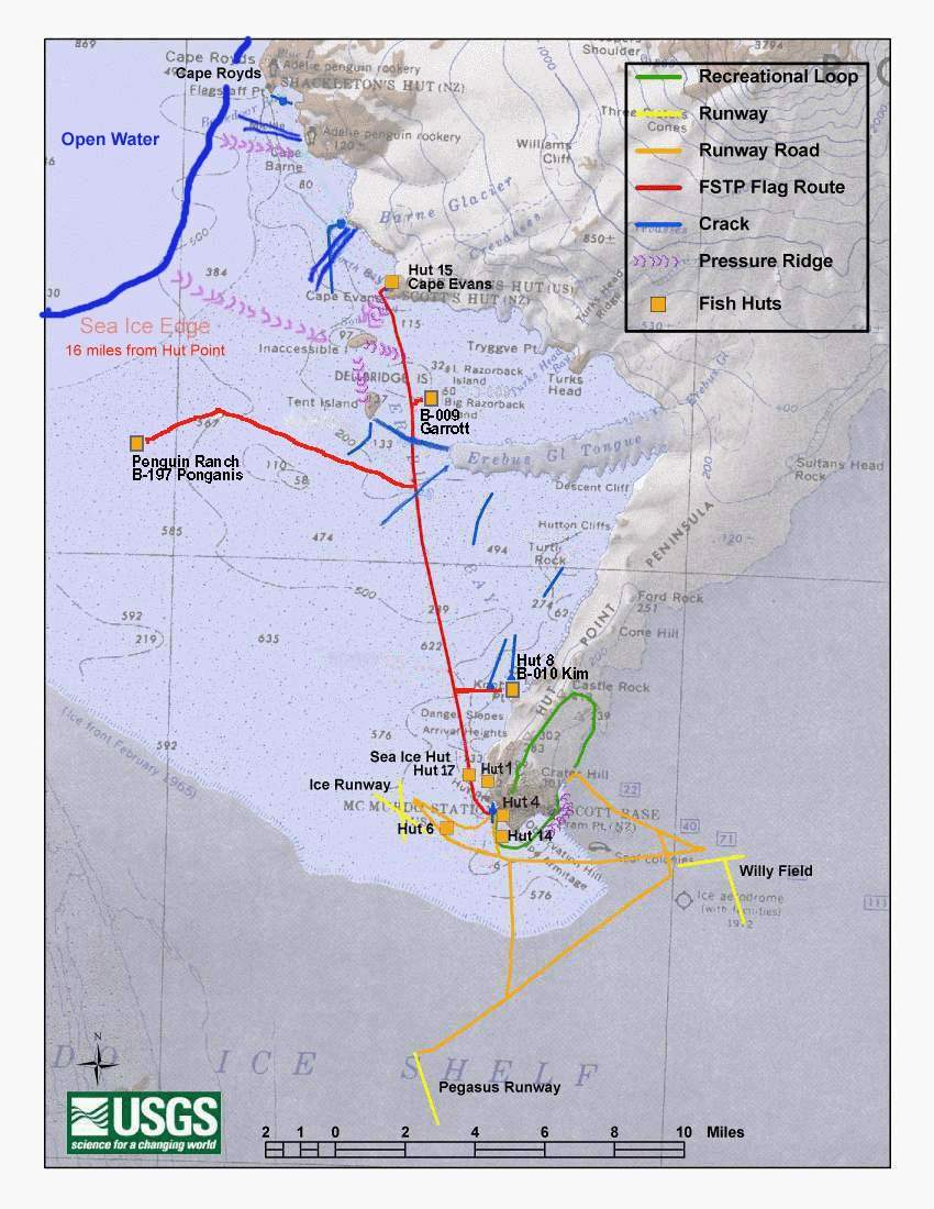
| This map was produced in October 2003 and shows the visual locations of McMurdo's runways, flagged ice road routes, research huts, and recreational trails. Positions of the roads and runways are roughly the same now (2007) as they were in 2003. Image produced by the USGS. Click on the image to get the full size version. |
 |