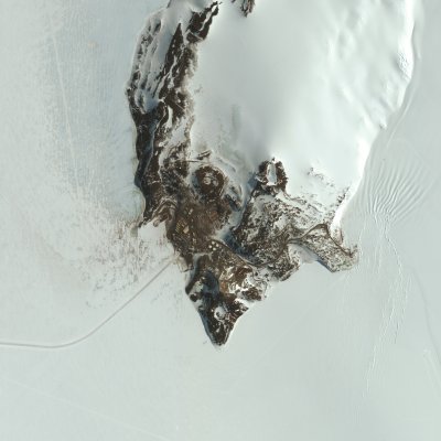
Simply put, it's on an island on the northwestern corner of the Ross Ice Shelf.
More specifically, the Lat/Long coordinates are:
77° 51' S
166° 40' E
Visually, it is:
On the shore,
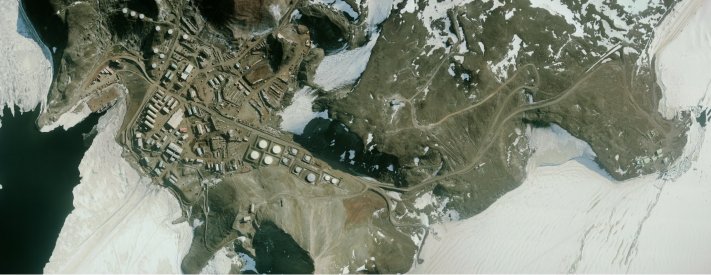
on the southern tip of Hut Point Peninsula, (image on the left courtesy of DigitalGlobe)
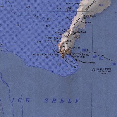
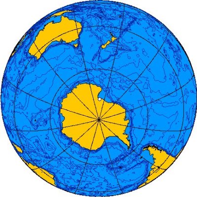
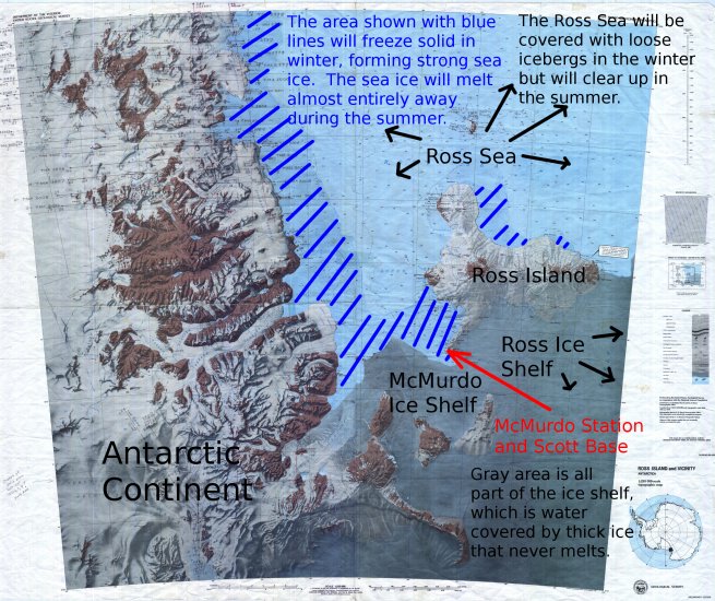
on the southern side of Ross Island,
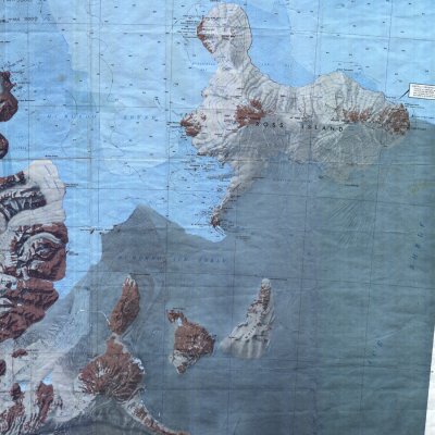
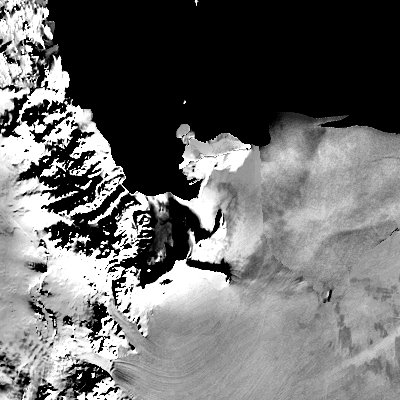
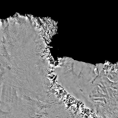
at the western edge of the Ross Ice Shelf,
adjacent to the Ross Sea,
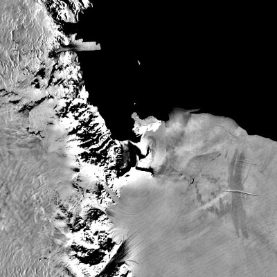
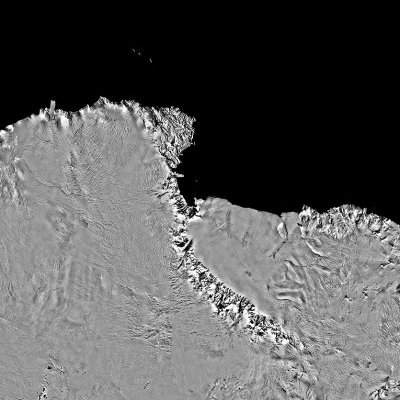
at the edge of Antarctica,
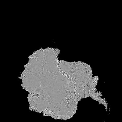
at the end of the earth.
All satellite images other than the DigitalGlobe image are from the USGS.
McMurdo is built on the southernmost point of Ross Island, at the northwest corner of the Ross Ice Shelf. The southernmost point of Ross Island is the southernmost point in the world where ships can land at solid rock. Every other part of the Antarctican coastline at this latitude and farther south is either practically inaccessible by sea, or is covered year-round with unstable snow and ice.
Ross Island is 2460 sq km, or 950 sq mi, making it slightly larger than Maui Island in Hawaii, or about 2/3 the size of Admiralty Island in Southeast Alaska.
The east and south sides of Ross Island are integrated into the Ross Ice Shelf and McMurdo Ice Shelf, respectively. The other sides of the island are surrounded most of the year by sea ice. Ice shelves are generally 30+m thick slabs of floating ice that are fed by snowfall and terrestrial glaciers, and never melt away. Sea Ice, on the other hand, will form in the winter and melt partially or entirely away in the summer. At McMurdo, we use the term "sea ice" to refer to continguous ice that is frozen to a shoreline or ice shelf. The proper name for such ice is actually "fast ice".
The following image is an edit of a USGS map showing Ross Island as it relates to the Ross Sea (which extends north to the South Pacific), the sea ice, and the ice shelves.
For a continent-wide view of the sea ice during different seasons, follow this link.
James Clark Ross was the first to map and explore the Ross Island area, naming the ice-free waters to the west of the island McMurdo Sound after one of his officers. Explorers Scott and Shakleton later sailed to Ross Island to establish bases for their South Pole expeditions. Scott chose to moor his ship at the tip of Hut Point Peninsula in early 1902, during the first of these famed expeditions. His party built a hut there which remains standing today.
McMurdo Station was established in late 1955 by the US Navy, at which time it was called the McMurdo Sound Air Operating Facility (AirOpFac). The US had plans to establish a habitable station at the South Pole by January 1957, and AirOpFac was established as a continually habitated logistics center and fuel depot for aircraft bound for the South Pole.
The location chosen for AirOpFac was immediately adjacent to Scott's hut. The Navy chose the site because it is the southernmost point in the world at which several conditions occur:
Ships can be berthed here, permitting relatively safe and economic transport of an immense volume of supplies. We currently receive 2 deep draft supply ships each year. Icebreakers always escort the supply ships in case the sea ice does not completely melt away.
Structures can be built on solid ground, making it possible to construct a robust, long-term outpost. Coastal outposts built anywhere else at this latitude have to be built on a cliff or on glacier ice, and any buildings built on ice will eventually be pushed into the sea.
The sea ice that forms around Hut Point Peninsula is thick, flat, and unobstructed, permitting construction of a seasonal airfield.
The nearby ice shelf, a short drive away, permits construction of airfields that can potentially be used year-round (although year-round flights are still yet to be achieved).
The succesful establishment of AirOpFac, later to be known as Naval Air Operating Facility, then Williams Airfield, and finally McMurdo Station, permitted the swift and succesful construction of the South Pole Station during the austral summer of 1956-57. Today, McMurdo Station remains the nearly exclusive supply source for the South Pole Station, and it now also supplies scientific missions covering nearly half of the continent.
With 3 airfields, a deepwater pier, more than 100 buildings, a summer population of 1,100, and with 3,000 people transiting the station annually, McMurdo Station allows the US to support a breadth of scientific projects and maintain a dominating political presence in the Ross Sea and South Pole regions.
For further information on the establishment of McMurdo Station, click on the following links for timelines, photos, and operational records of Operation Deep Freeze I, the US mission that established the station: